
Does early snow mean we’re in for a rough winter? Keith Carson explains


People walk through the first snow of the season on Oct. 27, 2018, in Hallowell. Does an early snow mean a long, dreary winter? Not necessarily, meteorologist Keith Carson writes. (Joe Phelan/Staff Photographer)
Parts of Maine accumulated snow on Oct. 13 and 14, and even by our standards, it was a bit on the early side. So does that mean we are in for a long, cold and snowy winter?
It’s not quite that simple. (It’s always been a sick dream of mine to write a setup like this and then end the article and not follow up.)

Maine meteorologist Keith Carson writes occasional weather stories for the Portland Press Herald. (Photo courtesy of Keith Carson)
Let’s start with analyzing other early first snows and what the rest of those winters turned out like. I’m going to use Caribou first, since southern Maine hasn’t gotten any snow yet this season, and we want to do apples to apples.
The average date when Caribou’s first inch of snow arrives is Nov. 7, with the earliest ever recorded coming on Sept. 29 (that’s messed up) and the latest on Dec. 12. Of the top 10 earliest snowfall years, not a single one of those years ended up in the top 10 for total snow by the end of the season (which I define as Oct. 1 through May 15, because I’m a realist). And those winters were, on average, below normal snowfall seasons.
Meanwhile in Portland, the average arrival of the first inch of snow is much more sane — Nov. 29 — with the earliest ever being Oct. 10 and the latest coming all the way on Jan. 16. Two of the 10 earliest snowfall years there reached into the top 10 for total snow by the end of the season. But the signal here is still very weak.
In fact, the earliest inch on record in Portland was 1980, and that year finished dead last (like me for 15 years in the “Best Weathercast” category at the Emmys) for total snow in Portland’s recorded history.
Advertisement
So, long story short, an early first snow in no way means that you’re in for a snowy winter overall.
But let’s zoom out further and talk about what we expect for Maine’s winter based on atmospheric teleconnections. As you’ve probably heard, we’re in the middle of a record-breaking El Nino right now.
See that line that looks like it doesn’t even belong on the same chart? Yeah, that’s this year.
“Godzilla,” “mega,” “unprecedented” — whatever you want to call it, it’s about as strong a teleconnection signal as you can get.
What does an El Nino winter in the Northeast typically look like? If I had to use just a few words I’d say, “wet and mild.” Here’s the official NOAA winter weather outlook, which strongly mirrors that description and is heavily leaning on the El Nino connection.

(Image courtesy of National Oceanic and Atmospheric Administration)
Note that the “mild” signal is a bit stronger than the “wet” signal. That’s because storm tracks are harder to predict at the seasonal level than temperature signals.
Advertisement
If I were a betting man, I’d say it’s very unlikely we have a colder-than-average winter. (We don’t have many of those anymore in general, because of climate change, but we did squeak one out last winter, which happens sometimes based on regional patterns and teleconnections.)
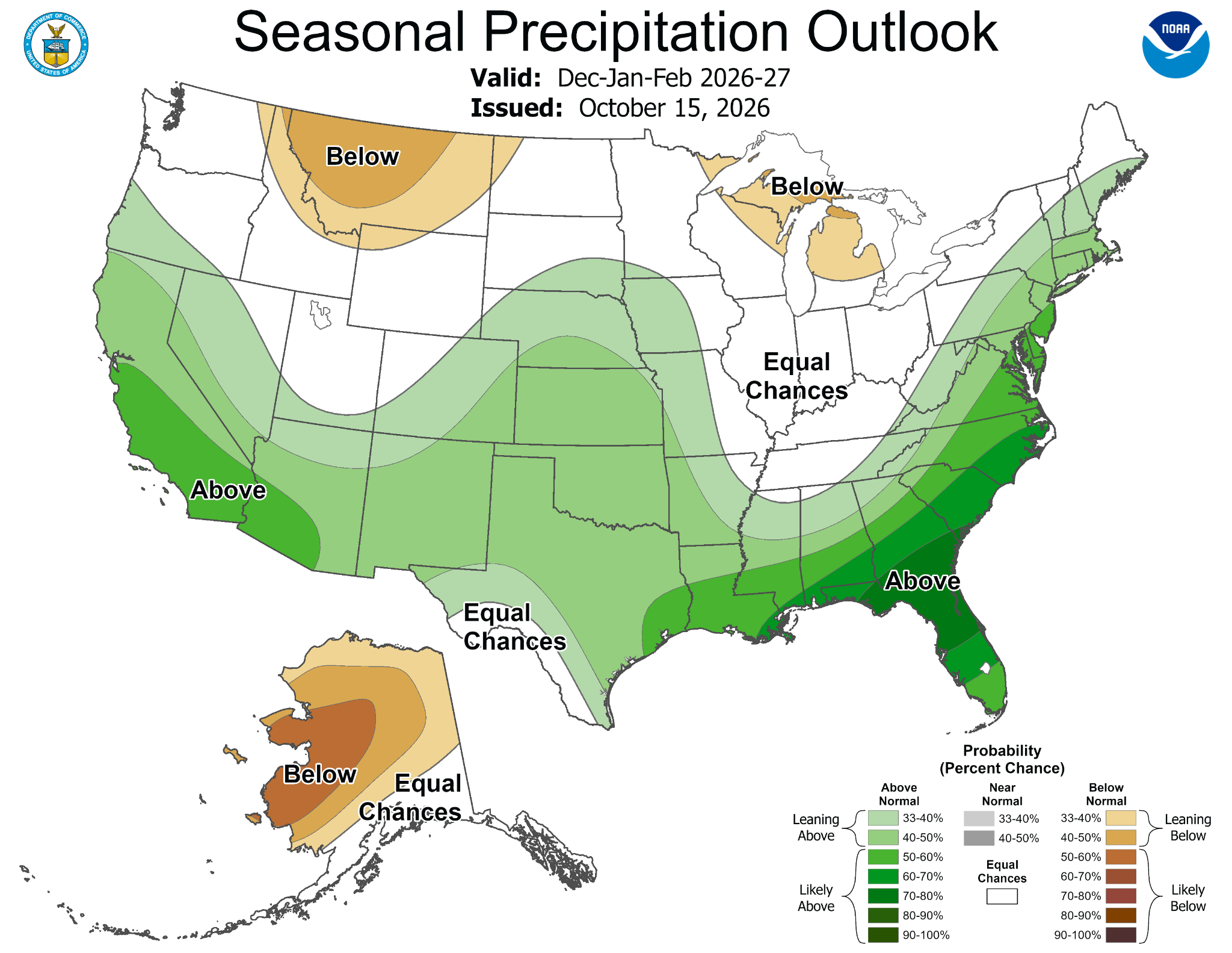
(Image courtesy of National Oceanic and Atmospheric Administration)
So taken at face value, we’re looking at a winter that runs above average temperature-wise and has a good amount of mixed precipitation events and a fair share of straight rain events, especially along the coast.
The split between the coast, inland Maine and the mountains could be a pretty big deal this winter, because temperatures being above average during a storm in a place like Portland very often lead to a changeover to rain. Inland, that could mean more mixing with sleet. The mountains, though, might be able to hang on to snow, even when the rest of the state gets rain. (This portion of the forecast was brought to you by Boyne Resorts and the Ski Maine Association.)
Historically speaking, even in the mountains, El Nino winters are not “big” for us when it comes to seasonal snow totals. But no teleconnection can dictate or predict wobbles in individual low pressure systems, and if we lock into a juicy pattern for a week or two, it will still be very wintry indeed for that time period.
But all things considered: I’ll take the under.

Related
Read more weather columns from meteorologist Keith Carson
Keith Carson, an award-winning Maine meteorologist previously of News Center Maine and The Weather Channel, is the director of environment & science communications for the Maine Conservation Voters nonprofit.
Copy the Story Link
Tagged: Keith Carson, National Weather Service, weather, winter weather